GENERAL FACTS
Country: Norway
Start / Finnish: Kristiansund / Molde
Total Distance: 8,274 km kilometers
Open end-to-end:all year
Road condition: paved, good.
LOCATION
It links the towns of Kristiansund and Molde, the two main population centers in the county of Møre. It starts approximately 30 kilometers southwest of Kristiansund and ends 47 kilometers north of Molde.
HISTORY
The first proposals to use this route were born in the 20th century. Planning of the Rauma Line to connect the national railway network to More og Romsdal was under way, and several proposals were made to extend the railway to the surrounding towns. In 1921, More og Romsdal County Council made the decision to build the outer route. Rauma Line was not built beyond Åndalsnes, and in 1935 the Parliament of Norway decided to connect the coastal towns in More og Romsdal to Andalsnes by road instead of rail.
Although the plans were official, locals continued to support the idea of a road connecting Averoy with the mainland. The toll company Atlanterhavsveien AS was established in 1970. Arne Rettedal, who was Minister of Local Government and Regional Development in the early 1980s, managed to allocate the job creation funds to road projects. This proposal was approved in 1983, after both Averoy, Eide and Fraena supported it. Construction started as a municipal road project on 1 August 1983, but progressed slowly. From 1 July 1986, the project was taken over by the Public Administration, increasing the speed for the construction and getting it done by 7 July 1989. During construction, the area was hit by 12 hurricanes.
DESCRIPTION
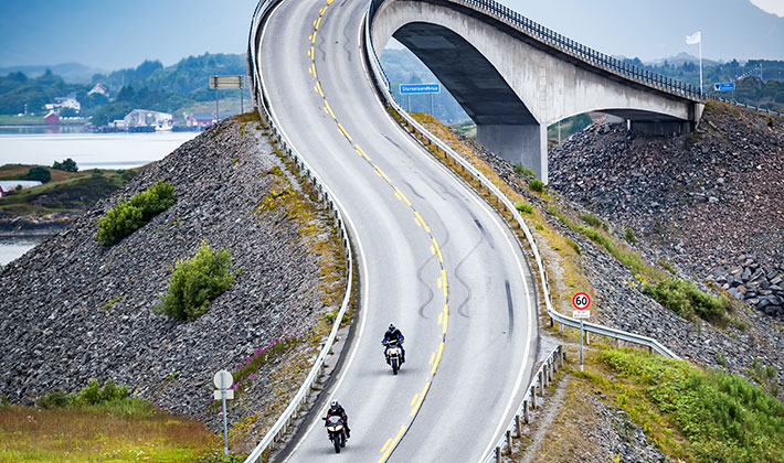
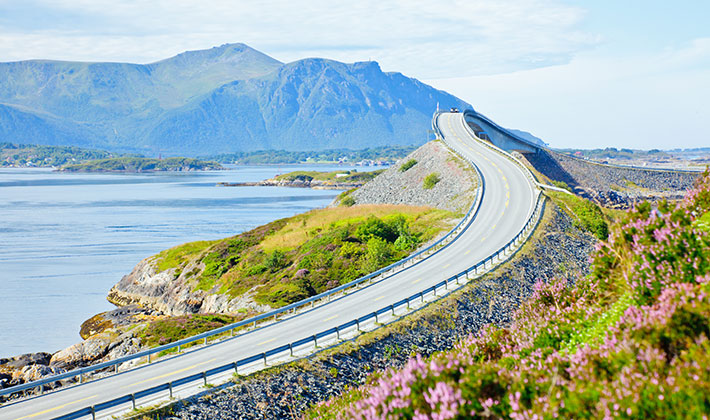
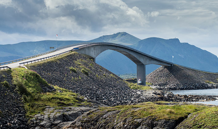
The Atlantic Ocean Road is an 8,274 km long County road that links the island of Averoy to the mainland at Eide. It runs through an archipelago in Eide and Averoy in More og Romsdal. On its way, his road meets up with Hustadtvika,an unsheltered part of the Norwegian Sea. It is built on several small islands and skerries, which are connected by several causeways, viaducts and eight bridges—the most prominent being Storseisundet Bridge. This road consists of eight bridges and four resting places and viewpoints. On the island the natives developed businesses to attract tourists such as: fishing and scuba diving resorts.
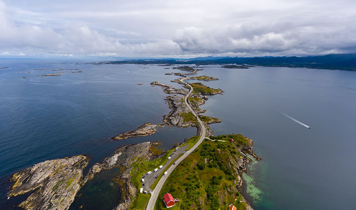
The road starts at Utheim on Averoy, close to the village of Karvag. It goes through the island of Kuholmen and then across the 115-meter long Little Lauvøysund Bridge onto the island of Lille Lauvoy. It continues across the 52-meter-long Store Lauvholmen Bridge onto Store Lauvoy. The nest bridge is Geitoysund Bridge to Geitoya followed by the Storseisundet Bridge. The last one is the Vevangstraumen Bridge which reaches the mainland. Along the way there are several resting places where you can get a snack or rest your eyes and even enjoy the memorizing view and the ocean’s breeze.

TIPS FOR TRAVEL
- The road is open all year, but due to windstorms there may be times when it is to dangerous to travel, so it’s best you check the weather before you go on the trip.
- If you are a driver, this is the right spot to come. The water is perfectly clear and there are lots of fish. You can also rent a boat and adventure in the lengths of the Atlantic